KLAMATH, CA – The Yurok Tribe received a contract from U.S. Geological Survey’s (USGS) 3D Elevation Program to collect and process 320,000 acres of lidar data on biologically diverse forests and salmon-bearing streams in Yurok ancestral territory.
“This project will benefit the tribe in many different ways,” said Yurok Vice-Chairman Frankie Myers. “In addition to strengthening our sovereignty, the data we collected will enhance ongoing efforts to holistically manage our landscape, mitigate for climate change and create a prosperous tribal nation. I would like to thank USGS, North Coast Resource Partnership and the California Natural Resources Agency for partnering with us on this project.”
USGS’s 3D Elevation Program, also known as 3DEP, is a nationwide effort to collect a baseline of consistent high-resolution topographic elevation data that can be used to inform critical decisions ranging from immediate safety of life, property, and environment to long term planning for infrastructure projects.
“USGS and the Yurok Tribe have a long history collaborating on data collection and analyses in the Klamath River watershed,” said Eric Reichard, USGS Southwest Regional Director. “The USGS greatly values this partnership, and this first-ever joint project in which the Yurok Tribe collects lidar data on their sovereign land is emblematic of the progress we have made together.”
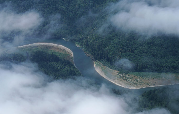
The Yurok Tribes Fisheries Department and the Condor Aviation Enterprise Program captured the data via a fixed-wing aircraft equipped with high-resolution remote sensing technology. The 500 sq. mi. project encompasses the Yurok Reservation and top half of Yurok ancestral territory in far Northern California. This ecologically unique landscape includes the lower 44 miles of the Klamath River, the Yurok Tribe’s 15,000-acre Blue Creek Salmon Sanctuary and one of the few remaining old-growth redwood stands on earth. The processed lidar data will aid in the design of fish habitat restoration projects on the Klamath River, which is the lifeline of the Yurok people and one of the last wild salmon strongholds on the West Coast. Additionally, the tribe will integrate the precise geospatial information into the planning of much-needed housing, road and utility infrastructure projects on the reservation.
Funded by the U.S. Geological Survey, North Coast Resource Partnership, California Natural Resources Agency and other stakeholders, the Yurok project is one component of a larger initiative to capture 17,000 sq. mi. of lidar data in the Northern California. The Northern California Airborne Lidar Project aims to establish the foundational data required to prioritize critical investments in the following areas: community health and safety, natural resource management, environmental restoration, forest fuel load reduction, water quality and quantity, and climate change resiliency.
Across Northern California, tribal, federal and state land managers are implementing a series of interventions, such as prescribed burning and fish habitat construction projects, to rebuild salmon runs as well as make forests more resilient to climate change and less prone to catastrophic wildfire. The use of lidar data and its derivative products will increase the efficacy of these pivotal projects, while also minimizing cost. Prior to the Northern California Airborne Lidar Project, the Yurok Fisheries Department and the Yurok Tribe Construction Corporation, in collaboration with state and federal agencies, had used lidar information collected by the Condor Aviation Program to bolster the design of highly successful, reach-scale river restoration projects in the Klamath Basin.
Once the Northern California lidar project is complete, the USGS National Geospatial Program’s nationwide 3D Elevation Program will incorporate the digital information into the first-ever national baseline of high-resolution topographic elevation data. Throughout the United States, this invaluable data informs critical decisions concerning a wide variety of issues ranging from the immediate safety of life, property and the environment to long term planning for infrastructure projects.


